

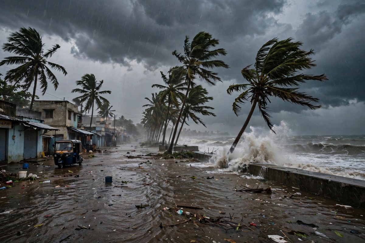
Andhra Pradesh had barely cleared up from one cyclone when the next one arrived. Severe Cyclone Murasu came ashore near Ongole in the early hours of Tuesday, 3 November, bringing winds strong enough to fell trees and power poles, rain heavy enough to flood fields and low-lying neighbourhoods, and a second week of disruption for coastal districts that were already recovering.
🌪️ 30-Second Signal — read this, you get the story
⚡Murasu crossed near Ongole early on 3 November, with winds of 110–120 kmph.
🎯2 dead, 312 houses damaged, and preliminary losses of ₹344 crore — figures are still preliminary.
🔭It weakened toward Telangana, with a yellow alert for 4 November — re-check IMD before you travel.
Tap to reveal what happens next →
IMD's final alert and damage totals, plus relief and rehabilitation updates for Guntur, Bapatla and Palnadu.
Tap, scroll and watch the numbers — the full story, with sources, is below. All figures are from the article, no new claims added.
It is the human scale of the storm, rather than its wind speed alone, that explains why it matters. Two people died in Bapatla district. Thousands of people spent the night in rehabilitation centres. Farmers watched standing crops go under water. And because the system was still moving inland as it weakened, the story on the night of 3 November was not only what had happened on the coast, but what rain was still to come.
What happened overnight
According to The Hindu's evening update, Murasu crossed the south Andhra Pradesh coast near Ongole, in Prakasam district, between 3:30 a.m. and 8:30 a.m. on 3 November. Earlier India Meteorological Department bulletins had described the landfall process starting around 1 a.m., which is why different reports give slightly different start times. The crossing window in the evening update is the clearer way to describe it: a storm coming ashore over several hours, not in a single minute.
The IMD's observed maximum sustained wind speed during landfall was 110–120 kmph. That is an observed figure, not the earlier forecast, which had put sustained winds at 100–110 kmph gusting to 120 kmph, with a storm surge of around 1 to 1.5 metres above the astronomical tide in low-lying coastal areas. Keeping forecast and observed figures separate matters here, because early reports and later updates do not always match.
Rainfall was the other half of the storm. Prakasam and Bapatla districts received around 200 mm of rain between midnight and 6 a.m. on Tuesday. By 9 p.m., the day's highest rainfall was at Marripalem in Palnadu district, with 263.75 mm, followed by Ganapavaram with 246.7 mm and Konanki in Bapatla with 213.25 mm. Five stations recorded more than 204.5 mm, classified as extremely heavy, and 21 stations recorded more than 100 mm across Guntur, Prakasam and West Godavari. In practical terms, that is not a single heavy shower. It is a day of rain falling on ground that was already wet.
The damage, in numbers
All of the figures below are preliminary, as reported in The Hindu's evening update from Andhra Pradesh State Disaster Management Authority managing director Prakhar Jain. They will almost certainly be revised as district officials complete their assessments, and they should be read that way.
| Measure | Reported figure |
|---|---|
| Deaths | At least 2, both in Bapatla district |
| Crops damaged | 52,459 hectares |
| Houses damaged | 312 |
| Preliminary loss estimate | ₹344 crore |
| People in rehabilitation centres | 12,230, in Guntur, Bapatla and Palnadu |
| Observed sustained wind | 110–120 kmph |
| Highest rainfall to 9 p.m. | 263.75 mm, Marripalem, Palnadu |
The two deaths were both rain-related and both in Bapatla district: a 25-year-old man in Chinnaganjam and a 65-year-old woman in Karamchedu, after buildings collapsed. That detail matters because early reports on Tuesday had said no deaths or injuries had been reported so far. The evening update supersedes those early reports, and any account that still says there were no casualties is out of date.
Beyond the headline numbers, the disruption was widespread and ordinary in its effects. More than 30 trees fell on roads and another 300 were uprooted across eight villages in Prakasam district. More than 200 cell towers were affected. Transport was hit, with more than 35 trains cancelled, 14 diverted and 8 rescheduled, and flights cancelled. Fishing boats were damaged, power poles were brought down, and standing crops were inundated. Guntur, Bapatla and Palnadu were identified as the worst-affected districts, with heavy rain also in Prakasam and Palnadu, and then in NTR and Palnadu districts bordering Telangana as the system moved inland.
Why a second cyclone in a week changes the picture
Murasu is the second cyclone to strike the region in a week, after Cyclone Arnab. The Hindu's evening update notes that damage from Murasu was said to be less severe than Arnab's, but that comparison should not be read as reassurance. A second storm does not arrive on a clean slate. It arrives on saturated ground, with trees already weakened, power infrastructure already stressed, and people already displaced or exhausted from the previous round of warnings and evacuations.
That is also why evacuation figures need care. Different outlets have reported different totals: 12,230 people in rehabilitation centres in the evening update, about 30,000 people planned for evacuation, and other reports citing larger numbers moved to safety. These figures are not necessarily contradictory — planned evacuations, people in centres, and people shifted in total are different counts — but they are preliminary and they conflict in places. This article therefore uses only the 12,230-in-centres figure with attribution, and otherwise says thousands were evacuated, rather than picking a larger total that has not been reconciled.
What happens next, and what to re-check
By noon on 3 November, Murasu had weakened into a cyclonic storm, and the IMD expected it to weaken further into a deep depression by Tuesday night as it moved northwestwards towards Telangana. Weakening, however, does not mean the rain stops. The system was still expected to bring very heavy rainfall over coastal Andhra Pradesh and Yanam on 4 November, and heavy rainfall in south Chhattisgarh on 3 and 4 November.
For Telangana on 4 November, The Hindu reported an IMD yellow alert for heavy rainfall in three districts — Bhadradri Kothagudem, Khammam and Mahabubabad — along with thunderstorms, lightning and gusty winds in many other districts including Hyderabad. Readers should note a conflict in the reporting here: older reports from 1 and 2 November gave a red alert for some of these districts on 4 November, while the later Hindu bulletin gives yellow for Bhadradri Kothagudem, Khammam and Mahabubabad. This article uses the later yellow-alert report as reported, and readers in Telangana should re-check the current IMD bulletin on the morning of 4 November before relying on any alert level for travel or safety decisions.
The signal to take from Murasu
Murasu is a reminder that cyclone risk in this region is not a single event but a sequence. Two storms in a week test not only sea walls and power lines, but the systems around them: warnings that people trust, evacuation centres that are ready twice, and damage assessments that are honest about being preliminary. The numbers in this article will change. The pattern — a warming Bay of Bengal, back-to-back systems, and rain that travels inland long after the wind drops — is the longer story, and it is the one that will matter again the next time a storm forms.
For now, the clearest signal is this: Andhra Pradesh's coast took a direct hit on 3 November, two people died, crops and homes were damaged on a large scale, and the rain had not finished by nightfall. Anyone in coastal Andhra Pradesh, Telangana or south Chhattisgarh should check the latest IMD warning before the morning of 4 November, not yesterday's.
How many people died in Cyclone Murasu?
At least two people died, both in Bapatla district in Andhra Pradesh — a 25-year-old man in Chinnaganjam and a 65-year-old woman in Karamchedu, after buildings collapsed. The figure is from The Hindu's evening update on 3 November, based on the state disaster management authority, and is preliminary.
Where did Cyclone Murasu make landfall, and how strong was it?
Murasu crossed the south Andhra Pradesh coast near Ongole, in Prakasam district, between 3:30 a.m. and 8:30 a.m. on 3 November, with observed sustained winds of 110–120 kmph, according to the India Meteorological Department via The Hindu.
Is it still raining on 4 November?
The system weakened as it moved inland, but very heavy rainfall was still expected over coastal Andhra Pradesh and Yanam on 4 November, and a yellow alert for heavy rainfall was reported for Bhadradri Kothagudem, Khammam and Mahabubabad in Telangana. Re-check the current IMD bulletin on the morning of 4 November, as earlier reports gave a different alert level.