
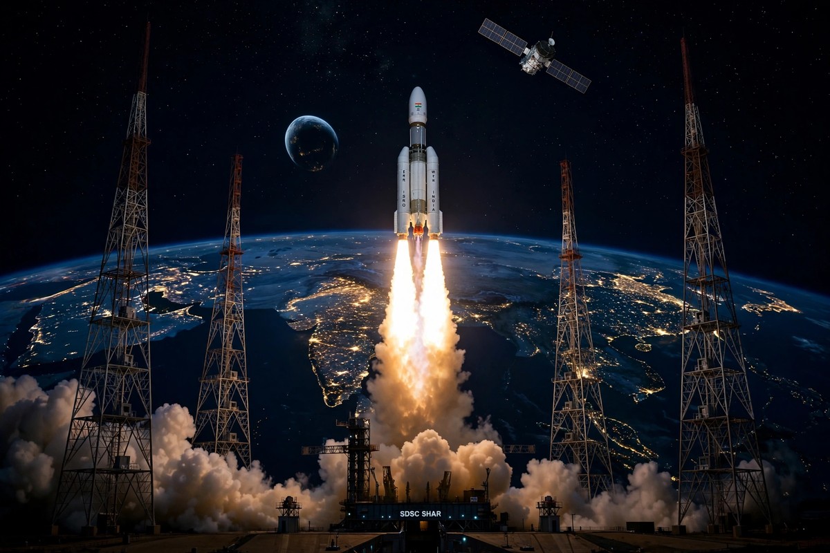
India has its own answer to GPS, and on the night of 30 October it took a step toward making that answer work properly again. ISRO's GSLV-F18 rocket lifted off from Sriharikota and placed the NVS-03 navigation satellite in its intended orbit, restoring the NavIC constellation toward the strength it needs to be useful — not just as a symbol, but as a system ordinary devices can actually rely on.
🚀 30-Second Signal — read this, you get the story
⚡GSLV-F18 launched NVS-03 on 30 October at 23:51 IST from Sriharikota.
🎯NVS-03 is the third second-generation NavIC satellite, with an indigenous atomic clock and the phone-friendly L1 band.
🔭Phones do NOT work better yet — the satellite is still being raised to its slot and commissioned.
Tap to reveal what happens next →
The commissioning date — only then will NavIC service, and any phone benefit, actually switch on.
Tap, scroll and watch the numbers — the full story, with sources, is below. All figures are from the article, no new claims added.
The story is a comeback as much as a launch. NavIC, India's regional navigation system, had been weakened by the failure of its previous satellite to reach its operating orbit. NVS-03 is meant to repair that gap. What it does not do, yet, is change anything on your phone. That distinction — between a satellite in orbit and a service in use — is the most important part of this story, and it is where many headlines go wrong.
What happened on 30 October
GSLV-F18 launched at 11:51 p.m. IST on 30 October 2026 from the Second Launch Pad at the Satish Dhawan Space Centre, Sriharikota. It was the 20th flight of the Geosynchronous Satellite Launch Vehicle. At 12:23 a.m. IST on 31 October, ISRO confirmed success, saying GSLV-F18 had successfully placed NVS-03 in the intended orbit.
NVS-03 weighs 2,232 kg. It separated from the rocket about 18 minutes after liftoff into a Geosynchronous Transfer Orbit of about 170 km by 37,023 km, inclined at about 20.75 degrees. That transfer orbit is not its final home. Like other geostationary satellites, NVS-03 must still raise itself to its geostationary slot and pass in-orbit testing and commissioning before it enters live NavIC service. That process takes weeks, and no firm commissioning date was found in the sources used for this article.
It is worth being precise about that timeline, because launch success and service readiness are often conflated in coverage. A satellite can be perfectly placed in its transfer orbit and still not be delivering navigation signals to users. NVS-03 is in the first category today. It is not yet in the second.
Why NavIC needed NVS-03
NavIC — Navigation with Indian Constellation — is India's regional satellite navigation system, covering India and up to 1,500 km beyond its borders. It provides a civilian Standard Positioning Service and a restricted authorised service, and it also provides precise timing used by banking, telecom and defence systems. In other words, it is not only about finding your way on a map. It is about time itself: the synchronised clocks that let financial transactions, mobile networks and power grids work.
NVS-03 is the third satellite of ISRO's second-generation NVS series, with NVS-01 to NVS-05 planned. It restores NavIC toward a functional four-satellite constellation after NVS-02, launched in January 2025, failed to reach its operating orbit when its propulsion valves failed to open. According to a Parliament reply on 29 July 2026, reported via The Week, only three satellites — IRNSS-1B, IRNSS-1I and NVS-01 — were delivering position, navigation and timing at that point. A navigation constellation with too few working satellites cannot provide reliable, continuous coverage, which is why a single replacement satellite matters more than its individual weight suggests.
NVS-03 also carries a notable piece of Indian engineering: an indigenous rubidium atomic clock developed by the Space Applications Centre in Ahmedabad, with procured clocks as backup. Atomic clocks are the heart of any navigation system. A satellite's position is useful only if you know, to extraordinary precision, when its signal was sent. An indigenous clock reduces dependence on imported timing components and is a small but real step toward a fully Indian navigation capability.
What changes for ordinary users — eventually
NVS-03 transmits in L1, L5 and S bands. L1 is the band used by GPS in most phones, and that is the detail with the most everyday significance. Once the NavIC constellation is complete and chipmakers and device makers certify it, ordinary smartphones, wearables and fitness bands could use NavIC more easily, with better accuracy in cities, for Maps, cabs and delivery apps. Design life for NVS-03 is about 12 years.
Notice the conditionals in that paragraph. They are deliberate. Better accuracy in cities is a plausible benefit of a fuller NavIC constellation, especially where tall buildings block or reflect GPS signals. It is not a benefit that NVS-03 delivers today, on its own, to a phone in your pocket. Device makers still need to certify NavIC support, and analysts cited in the research for this article note that NVS-04 and NVS-05 are still needed for the coverage continuity that device makers require before they commit fully.
This article therefore does not claim that phones already work better with NavIC, or that phone prices will fall because of NVS-03. Those are expected benefits, not present facts. The honest version is more interesting anyway: India is building, satellite by satellite, a system that could one day let its devices navigate without depending entirely on another country's constellation — but building it takes launches, testing and certification, not just a single night's success.
The numbers behind the launch
| Detail | Figure |
|---|---|
| Launch vehicle | GSLV-F18, 20th GSLV flight |
| Launch time | 30 October 2026, 11:51 p.m. IST, Sriharikota |
| Success confirmed | 31 October 2026, 12:23 a.m. IST |
| Satellite | NVS-03, 2,232 kg |
| Separation | About 18 minutes after liftoff |
| Transfer orbit | About 170 km by 37,023 km |
| Design life | About 12 years |
| Coverage | India plus up to 1,500 km beyond |
One secondary figure should be treated with care. Some secondary sources give NVS-03's weight as 2,250 kg and its final slot as 111.75 degrees East. This article uses 2,232 kg, the figure in the primary reporting used here, and does not assert a final slot from a secondary source alone. Small discrepancies like this are common in launch coverage, and they are a useful reminder to check weight, orbit and slot against ISRO's own release when it is available, rather than copying the first number encountered.
What happens next
The next steps for NVS-03 are unglamorous and essential: orbit-raising to its geostationary slot, in-orbit testing, and commissioning into NavIC service. Only after that will it start contributing navigation signals to users. After that, the longer programme continues with NVS-04 and NVS-05, which are needed to complete the second-generation constellation and give device makers the continuity they need.
For readers, the signal to watch is not another launch announcement, but a quieter one: the confirmation that NVS-03 is in live service, and then, over time, the appearance of NavIC support in device specifications and chipset announcements. That is when the story moves from space to the street — from a satellite in a transfer orbit to a phone that knows where it is, a little more accurately, without depending entirely on GPS.
Until then, NVS-03 is best understood as what it is: a successful launch, a restored constellation taking shape, and a reminder that India's most useful space programmes are often the ones that work in the background, one satellite at a time.
Did ISRO launch NVS-03 successfully?
Yes. GSLV-F18 launched from Sriharikota at 11:51 p.m. IST on 30 October 2026, and ISRO confirmed at 12:23 a.m. IST on 31 October that NVS-03 had been placed in its intended orbit.
Will my phone work better with NavIC now?
Not yet. NVS-03 is in its transfer orbit and still needs orbit-raising, testing and commissioning before it enters live NavIC service. Any improvement for phones, Maps or cabs is a future benefit once the constellation is complete and devices are certified, not an immediate change.
What is NavIC, and why does India need it?
NavIC is India's regional satellite navigation system, covering India and up to 1,500 km beyond. It provides positioning for civilian and authorised users and precise timing for banking, telecom and defence, reducing dependence on foreign navigation systems.